
LCZ4r: a new software for mapping Local Climate Zones and analyzing urban heat islands in Aracaju - SE
DOI:
https://doi.org/10.21579/issn.2526-0375_2025_n2_104-127Keywords:
Local Climate Zones, urban heat islands, LCZ4r, software, RAbstract
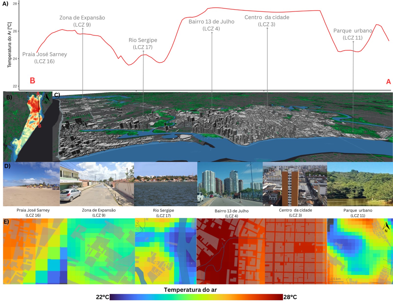
This study introduces LCZ4r, a new software designed to facilitate access to the Local Climate Zones (LCZ) system and analyze Urban Heat Islands (UHI). Developed in R, LCZ4r uses global LCZ maps and OpenStreetMap data to generate LCZ maps for any city worldwide. Additionally, LCZ4r performs time series analysis, computes thermal anomalies, and quantifies UHI intensity. The tool combines interpolation methods with LCZ classes to model high-definition spatial and temporal temperature variability, spanning frequencies from hours to years and spatial resolutions from meters to several kilometers. This study demonstrates the application of LCZ4r in the city of Aracaju–SE, using temperature data collected across different LCZs between 2014 and 2016. The results highlight that the LCZ4r tool not only simplifies the classification and analysis of LCZs but also enhances the understanding of local variations in urban thermal patterns through its combined kriging-LCZ approach. This underscores its potential as a practical and valuable tool for urban climatology studies
Downloads
Published
Issue
Section
License
Copyright (c) 2026 Revista Brasileira de Geografia

This work is licensed under a Creative Commons Attribution 4.0 International License.


